TAT 49 Oregon. Last day and rain, rain wouldn’t go away.

TAT Section 49

We can’t get out of Sunny Valley fast enough, the garage next door is closed but the local shop is open!


Featuring a line of products stretching back 40 years or so. 
 

Spot the fresh produce.
 Turns out the owner has been to the UK many times and used to ship containers of goods to sell in the U.S. His hand shake is like catching your hand in a closing door.

Heavy rain forecast so the bike’s indicator gets a weather proof upgrade.


Once on the trail the day brings lots of road and rain. We leave the town of Glendale in a downpour, about six people wave and salute us; I like to think they know what route were on.  Town smells of fresh cut pine.

After a long time riding in the mountains we’re bored of road and take a difficult red route in the hope of finding trail – it’s road too.

Finally we get some good trail, I enjoy every turn as it’s going to end soon… It doesn’t though !

Relentless rain makes a long and slightly rocky trail hard work, just enough so you can’t relax. On the final decent from the mountain arms are like lead I’m knackered, hands frozen and boots full of water.


Bit of logging
Port Offord, at long last!
  

finally on the beach
  

Here’s the final point for the moto.
  

End of the road, some 6000 miles and 6 weeks. A truly fantastic, relaxing, thrilling, scary and fulfilling ride. Loved it and would do it all again… with maybe a few more days training.

Tat 48 Oregon, how it should be!

TAT Section 48

The penultimate day… Is a great day!

 Full of blocked roads, adapting the trail and an afternoon snooze.
We start out of the ‘last resort’ and the valley shrouded in mist.  A slight climb and the trail gives a breathtaking valley full of burned out trees. Only a couple of miles in and it ends in a landslide. (NF4720)

Just couldn’t clear it.
N 43*17.458′  W 122*40.881′

We have to take the EZ route. (NF-4714) It’s road, but a great climb, packed full of twisty turns.


Then it’s good, graded gravel track beautiful scenery, what we hoped Oregon would be the day before.

We rejoin the trail proper (NF-27) but it takes a right onto NF-2741 and after a few miles it’s blocked.

N43*06.178′  W122*42.836 

Old trail.
 This is a man-made obstruction and the road beyond has been abandoned for some time.
We go back to NF-27+28 following the EZ route for quite a way.
We join up with the trail again and again it’s deliberately blocked; another abandoned road: NF-400 / NF-3144 

This time it’s a big detour.

We get to Tiller and… there’s another obsticle!  90,000 acres of burnt out forrest – explains the earlier desolation. Another detour!


I enjoyed adapting the route like this, making up our route as we go along.  thanks to Sarah and Tom of Swallow bicycle works for showing us the easy way using http://ridewithgps.com app.

We work our way round and after reading the last section of trail is an evil goat track, we stay on the EZ route to make Glendale by nightfall. 160 miles in total so ready for a good sleep…  There was motel type place off the highway… Instead we booked ahead into ‘Sunny Valley’.

Just don’t.


 There were no roaches, but damn…

TAT 46+47. Oregon and rain.

TAT section 46 Lakeview to Crescent. 66 miles.

TAT Section 47 Crescent to Dry Creek Store. 74miles


Onwards to Crescent and we get an unwelcome surprise. The Deschutes national forrest and mountain range look gorgeous but underfoot things become… sandy. Some deep parts too, the bike twitches all over the place, could not relax for a minute. Nervada mountain I call it.

Bit of an obstacle. 

Eventually a nice red graded trail.  It soon runs out and the sand returns; not as bad as the first section, but still this is not the Oragon I was hoping for!

TAT Section 47 Crescent to Dry Creek Store. 74miles

We make it to Cresent OR. It’s rainin and there are a couple of motels to stay but it’s only lunchtime – we push on, taking the EZ route and a detour to Creator Lake.   

S’nice but cold. We join the EZ route to Umpqua’s Last Resort. It was all road for the last section but a beautiful road, winding down along the river through clouds and gigantic firs.

  http://www.umpquaslastresort.com/store-station/

We arrive too late for food but in time to book a cabin for the night. Pushing the boat out in on the last nights on the TAT.

TAT 44+45. Oregon, two fast days.

TAT section 44 Cedarville CA to Lakeview OR. 67 miles.

TAT Section 45 Lakeview OR to Silverlake OR. 120 miles.

Cedarville on one side of the street, Surprise Valley on the other.


A cinebun!
 
image
We leave Cedarville, aka Surprise valley, travel through a forested mountain range. Nice going with a little steep rocky section near the summit.


   Some big pot holes on the way down. Only mention them as they are a rare.

After 67 miles, we suddenly pop out of the creek into Lakeview OR.  It’s only just lunchtime so got supplies, did laundry and an oil change. Early to bed.

TAT Section 45 Lakeview to Silverlake 120 miles.

Another easy day, a bit of rock and sand at the top of the mountain of Fremont forrest.


 Took a wrong turn but kept going down an abandoned track – it eventually joined the TAT and was the most fun all day.


Safety first. A dangerous log in the way… I forgot about my bruised ribs

Found some mushrooms. Silverlake was a town with little going on; except a booked / closed motel. Went further north to summer lake lodge and in tried a random trail and wound up in silver late itself… oops. Badger hole…  

The summer lake lodge is an uncomfortable mix of bird watchers and shooters… In the evening red flashing lights around the area indicate it’s time to stop killing the birds.

TAT 43. Aaah back into Nevada!!

TAT Section 43 Fields OR to Cedarville CA

We all depart Fields station together…


Turns out, to fit California into the TAT there’s a little loop that takes you back through Nevada. Joy, and with it came a new surface I’ve never seen before… Talcum-sand-powder.

 
And finally – I missed it – just after this clip Grant comes off… Naaaaahhhhaha!  

  
 There is another mile or two of talc  sand in the next valley. We took the EZ nice gravel road instead. 

A last 20mile stretch of asphalt to finish Nevada.
We’re so happy to be able to say goodbye… again (Soz R and G of Lost valley x) 

Happily we’re in Cederville (AKA Surprise Valley) California!

We head to ‘Woody’s’ for supper. Best food in a long time. Produce of the owner’s ranch. The hound knows it’s good  too.     


This is Woody!  He’s got a 150 acre ranch. Sheena helps herself behind the bar and cusses n swears with the best of ’em. She wears her daddy’s belt buckle with pride.    

Three rowdy Cowboys come in and back out, one with blood all over himself. Woody takes us out back, shows us what they’re up to…


Drunk as skunks, trying to skin a couple of bucks. Woody says he can’t watch as they try to hook up a rope from the ceiling


 A great night! Invited to go shoot rabbits but the bloodlust subsides and it’s time for bed.

TAT 42 Nevada into Oregon.

TAT 42 McDermitt to Fields
Off to Oregon but not before a visit to the ‘rock shop’.  In no mans land between the state lines of Nevada and Oregon there is ‘Orevada’. Its weird. 
    Rocks for sale.
 On the road, it’s a bit sandy, bit rocky but better than sandy ruts before!
  

Sadly this lovely valley had a locked gate.  

We go back 1.7miles to ‘White Horse 15 mile road’ for the detour.  A muddy river crossing follows! 


Scope it out… n’go for it!  Grant prefers to build a small bridge of rock and branches – sensible chap. 


But a stall on his bike means we have to wait for it to cool off. It’s a  kick start that won’t start when it’s hot….

 Electric start is best, esp when there’s lots of flies…  Smugness.

We make it to Fields OR
No rooms available (there are only two) but the lovely Sarah and Tom have a spare bed in theirs – they kindly let us stay. 

http://sbwxtat.swallowbicycleworks.com

Www.swallowbicycleworks.com

Turns out they are riding the TAT on their own brand bikes! Super nice and chilled, their lack of of luggage is a fascinating. They switched to GPS Kevin version of the TAT.


TAT 40+41 Nevada.

Nevada TAT 40 Eureka to Battle mountain. Then TAT 41 Battle Mountain to McDermitt.

Out of Eureka NV and its sandy-ish tracks.


 Then we take TAT 40 EZ route – miss a diversion and wander into a gold mine. Not obvious at first!


This conveyer belt stretched all the way to the mountain in the distance.
     

We get to Battle Mountain, stay at the Owl casino-motel-resturant.  Bit grim. Good Mexican Resturant on next block – with excellent frozen margaritas! Former glory

TAT 41 Battle Mountain NV to McDermitt NV.   Out of Battle Mountain, 20miles of fast gravel road then sandy tracks.


Just when you think it might end… There’s more.  Not deep sand but in ruts – with enough patches to keep you on your toes.  No only likes a sandy rut.


A special farewell to that bit.

Who’s ever car this was… 

Liked Randy Travis.

Finally came to the deserted Red Farm of dry Creek.


After 20 min we’re off and switch to the EZ route. A good option – that took us up into Humbolt forrest.

Probably the best mountain Nevada has offered so far.
 A 4h cabin at the top, open for public use / refuge.

The descent was pretty interesting at times. Not the best maintained trail. 

These rancheros were looking for their cows!   

Didn’t see em, but did see a big horn sheep ! 

Arrive at McDermitt on the border of Oregon (sooo nice to be almost out of Nevada). Stay in a Casino Motel again.


The ‘Say When’ Casino, with interesting pamphlets

TAT 37+38+39 Utah. Mustang! 

Utah to Nevada

TAT Section 37 Kanosh to Baker 125miles.

Next day TAT Section 38 Baker NV to Lund NV, PLUS TAT Section 39 to Eureka NV.

 Richfield NV, a nice cafe and a barbers for a tidy up. Doug here was dragged off by a bear when he was a kid.  Nice thoughtful man.


The pass from Richfield to Kanosh UT was good, steep downhill in parts and a bit washed out in others.
  Edit 
 Then from Kanosh UT to Baker NV it’s big fast wide gravel roads – you can make up time here!

   It goes on an on into Nervada… I think I went a bit dolally.


Baker Nevada
.  Stayed at the ‘Silver Jack Electrolux Cafe’ a band was playing, place was lively.  In the morning I met Grant; He’s riding a Honda xr650r and doing the TAT!  Also he hit a cow yesterday so we both have bad shoulders!

These are his pics of the evil pass in Utah… Came a cropper in the exact same spot as I did!


I was glad to hear it wasn’t just me that struggled, sensibly Grant  turned back and took the alternate Muddy Road route.  

Had to do a quick fix for a newly smashed indicator (A strap came lose and wandered into the wheel.) Gatoraid bottle top does the job.

So we ride out together! He’s better and way faster than me – I learn about speed on the trail.  There’s lots of washed out roads on TAT Section 38.

  
 We go through a tricky forrest of short, scrubby trees called ‘fortification range’. It’s hardly a trail at times, you have to pick your way through.

 Once out your into a bowl of gravely sand… Ugh.

IMG_0059Finally we exit Sawmill Peak, into the next basin and fill up at the town of Lund. There’s nothing else there so as the sun was setting so took the TAT Section 39 EZ option to get to Eureka.

Mustangs! So cool, the Wild West!

 …came a cross a mile or two of unpleasant sand. Crossing Patterson pass met a hunter called Hal with what’s left of a young buck. He was leaving it for the mountan Lions.

  The trail kind of petered out  for a tiny bit, we were riding in a mass of Sage / Rosemary bushes – Smelt lovely.

More mustangs and sand

  
Then it’s about 40miles of highway and your in Eureka!


Stayed in the Sundown lodge motel – ran by Mennonites it’s the best I’ve stayed in yet! Not pictured obvs.

TAT 35+36 Utah, a tough cookie.

Tat section 35 Green River UT to Emery UT 91 miles. TAT Section 36 (the first bit!)

Woke just outside Green River. A cold night and slept badly as a cactus had punctured my inflatable mattress… Shoulder and ribs hurt from the muddy falls yesterday; I can only just get my jacket on! Still, first change of gear is always a good feeling!

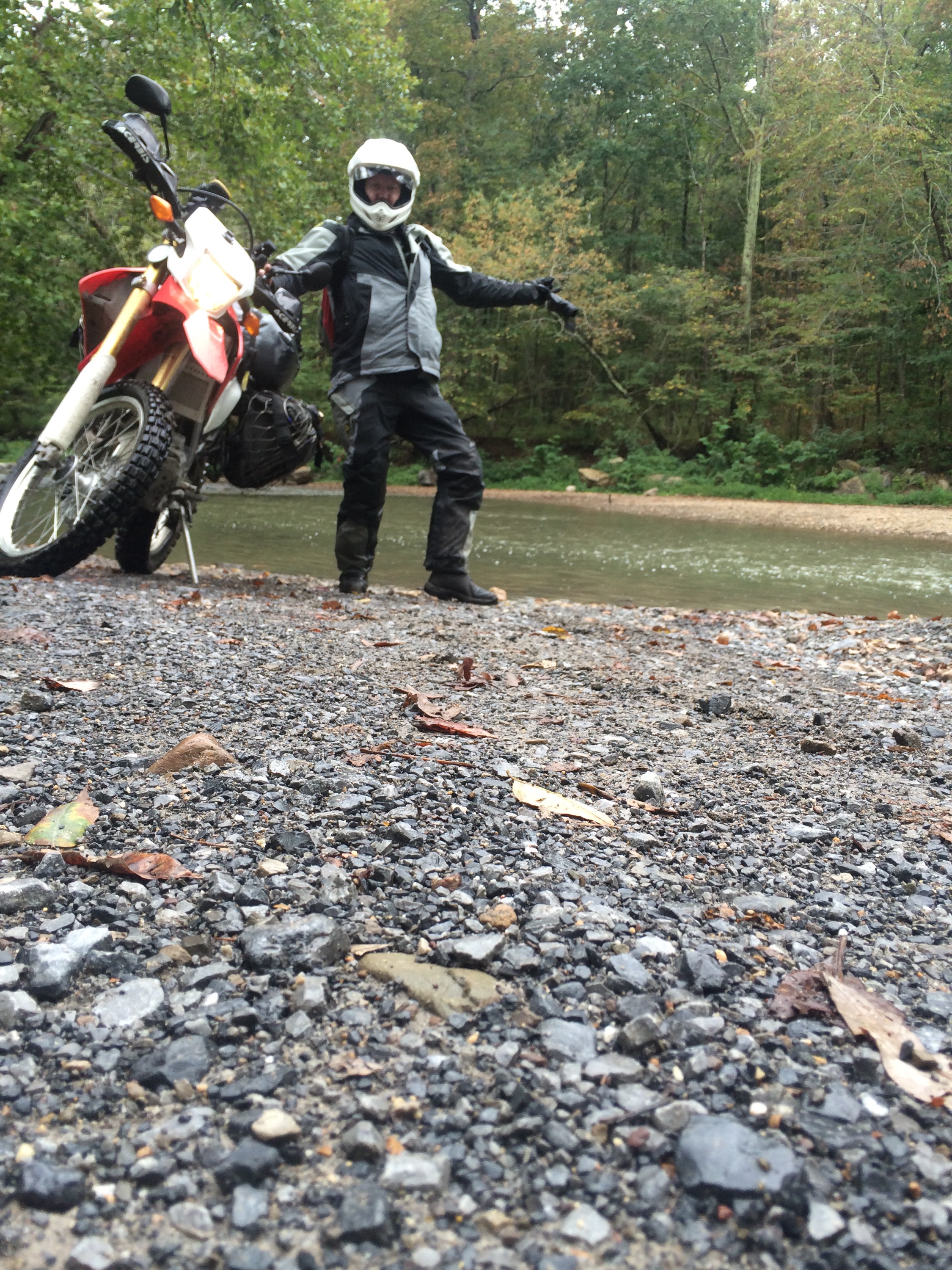
Guy washing the garage forecourt nicely blasted of the mud off the bike. 

I figured with the shoulder, I’d take it easy with the Tat 35 EZ option out of Green River.  A rider’s report said: “We took the easy route and crashed in sand about 4/5 times but made it to ferron state park”.  Oh great.


Nice going, no falls, probably a different story if wet.  Some long flats once you hit the camping park, I carried on to Emery.


Emery was an empty town so I pushed on, TAT Section 36 -Kanosh and Richmond.
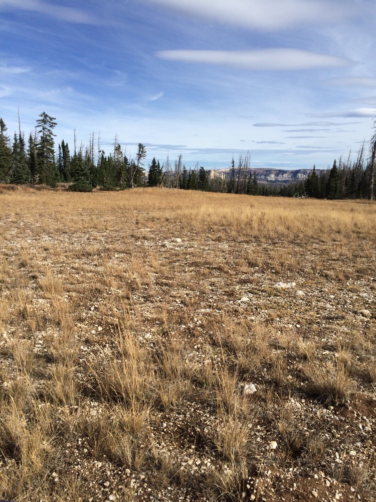
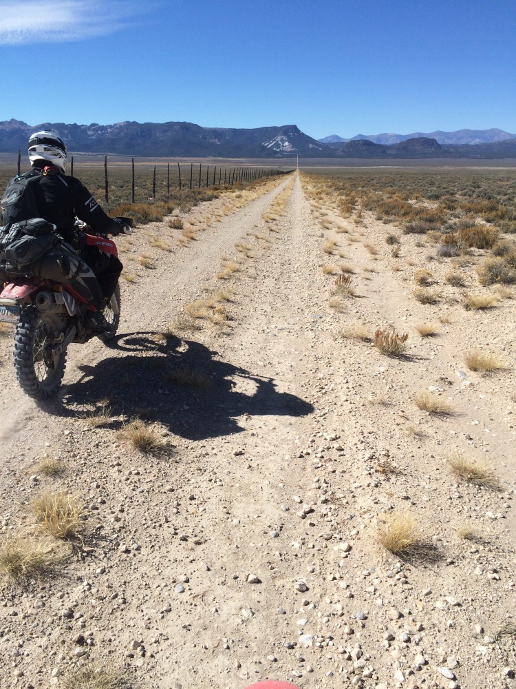
Odd alien zone.

  
 Getting into the first climb of White mountain – Some steep inclines.

Lovely view.
Ops. Then the dry rock Slowly becomes a moist black soil, with Flint like rocks.

Try riding over this thing without closing your eyes.
Edit
  

In the Forrest the black soil gets slippy, a pannier catches a log and I’m off.  Too steep to get back on the bike so had to walk the it up the hill (under its own power with me trotting alongside), only to meet another, even steeper incline.

It’s 6.30pm I can’t get up the hill and going back down is just as ominous…
 I only had enough water for food, I pitch camp resigned to the fact I might have to go back down in the morning. The infateble mattress is still home to cactus spikes so another cold night 3000m up!

Next morning I woke fully determind to get up that hill. Found a stream, filtered and drank lush cold water. Stripped the bike of all luggage and attempted the track again. 

Here is the struggle. Boring but you get the idea!  I managed to walk the bike up, went back for luggage on foot.


Turns out there’s five more of these hills, with the last one strewn with tree roots. I had come too far so went for it, on the bike, with full luggage and got over them all!  I think it was the toughest part of the trail by far, not technically but it took… gumption! The top wasn’t all that.

IMG_9921-0

“More difficult” Understatement of the year.

A fork needed a little clean out but good to go. 3300m up, only down hill from here.


Met a load of cattle, a deer and a rancher Tom.  His horse was cool, it picked it’s way through thick forrest.

Spot the deer!

 After the difficult pass I ignored the EZ routes and enjoyed the final TAT 36 sections –  it was twisty like ‘the dragons tail’ but made for dirt bikes.  Just a little crossing…  Kept going and the last hill down is a smooth carpet of slightly tricky loam type soil, smell of fresh pine was intoxicating – soon found the source of the smell, this cat was mauling everything by the side of the trail.


Widening the road for asphalt !?

Finally made it to Richmond and via air B&B, stayed with the lovely Bret and Zoe. Phew